Posted on July, 6, 2021 at 08:14 am
The Intergovernmental Authority for Development (IGAD) has launched the East Africa Hazards Watch, a regional public multi-hazards monitoring system. A team of programmers, climate scientists, earth observation and systems specialists, as well as Marketing, Design Thinking and sectoral experts, developed the system. The system will monitor droughts, climate change, pests, heavy rains, floods, or crop failures.
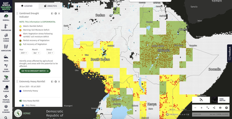
The East Africa Hazards Watch supports tracking extreme events such as droughts, cyclones, pests (desert locusts), heavy rainfalls, floods or crop failures. These events are increasing in frequency and intensity due to climate change. About 90% of the disasters in East Africa are due to weather and climate hazards, making the region one of the most vulnerable to extreme events. Considering the high dependency of the economic systems in the region on natural resources, the impacts of weather and climate extremes have far-reaching socioeconomic consequences. Therefore, there is a dire need for efficient early warning systems and actionable information for decision making. The East Africa Hazards Watch will fill this gap.
This public regional multi-hazards watch system also aims at providing decision-ready information. This information will consequently support transnational coordination and early action across borders. In addition, automated email and mobile phone notification Alerts and AI-based advisories are next on the development pipeline.
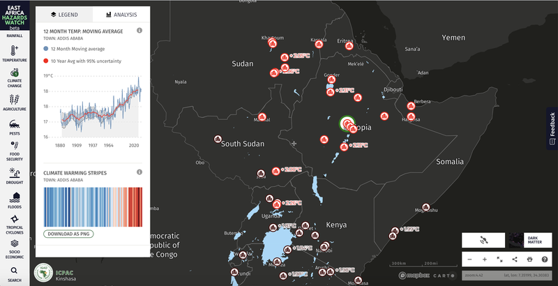
 Likewise, the system allows tracking the warming of East African cities. Climate Stripes allow visualising the warming of the main cities, which have already warmed by over 2 degrees since pre-industrial times. The developers are also currently integrating additional climate change layers which will allow citizens to understand how temperatures and rainfall have been changing in the last century.
ICPAC’s Desert Locust projections allow identifying areas at risk of desert locusts.

Agricultural warnings using satellite observation and ground data allow identification of areas at risk of crop failures.


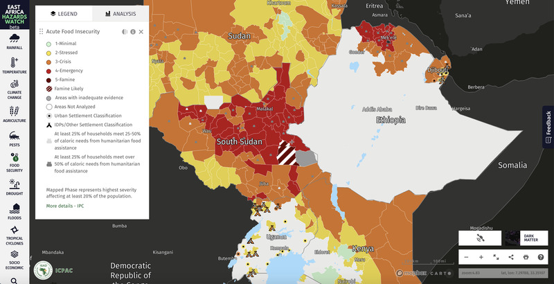
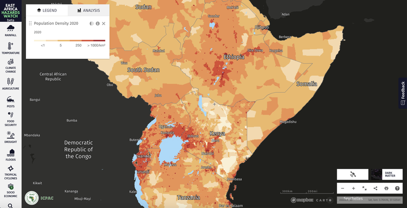
The system allows overlapping alerts and warnings with socio-economic information to understand the population’s vulnerability at risk. The developers are currently integrating and adding additional layers of information on vulnerability and exposure to the platform.
The platform is continuously iterated based on user feedback. IGAD developed the system in Africa for Africa. Furthermore, the system relies on Open Source platforms to ensure sustainability and endless customisation. The system supports integrating multiple data sources to provide a seamless user experience in finding risk information for the region.
Source: Africa News